Exploration Services
Secondary Deposit Exploration
Under nearly all conditions, Resistivity/IP is a promising method for investigating sediments and bedrock depth in the exploration of commercial placer deposits.

Resitivity/IP enables the identification of stratified layers such as humus, silt, clay, and gravel. Of particular interest is measuring the depth and topography of the bedrock, which is essential for locating paleogene river terraces, benches, and paleo-channels.
Resitivity/IP is also highly effective in imaging permafrost and groundwater conditions ̶ key factors for a commercial evaluation and environmental assessments.
Economically viable placers are primarily formed through alluvial and eluvial processes, as demonstrated by the most successful mining projects worldwide. The main resources extracted include tin, titanium, diamonds, gold, and rare earth elements.
2D Resistivity: Measuring different Types of Gravel
in a scenario with complex stratification, disrupted by anthropogenic influences

paleogene river terraces, benches, and paleo-channels.
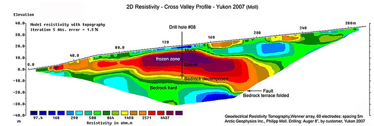
2D Resistivity: Measuring Bedrock Topography:


Auger Drilling of Resistivity Profiles for
verification of interpretation and targeted sampling

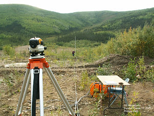
In placer mining, auger drilling is a popular method for sampling near-surface sediments and the bedrock interface. This is due to the simplicity of the technique, the immediate availability of sample results, and its relatively low cost. While the method can be affected by groundwater inflow, subsurface obstacles, vibrations, and mixing of stratified materials, it generally provides useful preliminary results for further exploration.